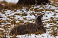
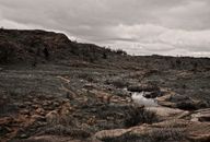
Starting November 17, Wichita Mountains Wildlife Refuge will close several familiar lakes, trails and picnic areas while selected hunters enter assigned units for the first controlled hunt of the season. That may sound like a contradiction: a public refuge restricting public use to provide a public hunting opportunity.
It is not a contradiction. It is the operating cost of making different kinds of public use occupy the same landscape without pretending that a rifle hunt, a family picnic and a hiking trail can all happen in the same place at the same time.
The U.S. Fish and Wildlife Service says the November 17–19 hunt is being conducted with the Oklahoma Department of Wildlife Conservation to provide hunting opportunities and help manage deer and elk populations. Hunters are selected through a drawing.
For public safety, the refuge is closing areas between the visitor center and Indiahoma Road. The closures include Quanah Parker Lake and Dam, Boulder Picnic Area, Lost Lake, Burford Lake, Osage Lake, French Lake, Burma Road, the Narrows and the Dog Run Hollow Trail System.
Other areas will remain open, including Mount Scott, Elk Mountain, Charon’s Garden, Post Oak and Treasure lakes, Jed Johnson Lake and Rush Lake. The refuge says closure areas will change during later controlled hunts scheduled for December and January.
A permit is not permission to use the whole refuge
That division of ground is the important part of the story. A hunting permit does not give a hunter the refuge. It gives that hunter a controlled opportunity within a particular system of units, dates, rules and boundaries.
The refuge covers approximately 59,020 acres and supports fishing, hiking, camping, wildlife viewing, photography, kayaking and other recreation. The Fish and Wildlife Service describes it as a working landscape for both wildlife and people, not a hunting preserve with other visitors allowed in by accident.
That means somebody has to decide where a hunter may be, where a photographer may be, which roads remain usable and how all of them receive the same information. The work is not in the announcement that opportunity exists. The work is in the map.
The hunt is controlled because the landscape is shared
Wichita Mountains is not using hunting as a free-for-all. The refuge’s hunting guidance explains that deer and elk hunts are conducted through the state’s controlled-hunt program. Hunters are assigned to units and must attend a safety and orientation briefing. Blaze orange is required. Centerfire-rifle rules apply, and harvested animals must be checked at the refuge station before a transportation tag is attached and the animal leaves refuge property.
Those requirements are not ceremonial. They are how managers turn a large, complicated public landscape into a hunt that can be supervised.
The refuge also says the elk herd began with Rocky Mountain elk reintroduced in 1911 and 1912 after native Merriam’s elk had been eliminated. Controlled hunting has been part of the refuge’s public-use system for decades. The objective is not simply to put animals in front of hunters. It is to manage populations within the habitat available while preserving a legitimate form of wildlife-dependent recreation.
That distinction matters. A hunt can be biologically justified and still be poorly managed. It can also be carefully managed without guaranteeing that every hunter sees an animal, gets a shot or brings home meat.
The draw creates opportunity. Preparation makes it usable.
The refuge says several thousand people usually compete for limited deer and elk opportunities, with approximately 30,000 applicants competing for the elk hunt alone in some years. That is an agency description of typical demand, not a verified count for the November 2026 hunt.
What a successful applicant receives is not a finished experience. The hunter still has to understand the assigned unit, the closure boundaries, the orientation requirements, the firearm and ammunition rules, the check-station process and the transportation requirements after a harvest.
This is where outdoor competence separates itself from the picture people carry in their heads. The difficult part of a controlled hunt may be the shooting, but it may also be arriving prepared, staying inside the assigned area, moving safely through unfamiliar ground, recovering an animal and completing the paperwork without creating a problem for the next person.
The draw removes some uncertainty about whether a person may participate. It does not remove the need to read, navigate and make good decisions.
Nonhunters have responsibilities, too
The same is true for visitors who are not hunting. A public refuge is not automatically open in the ordinary sense during a controlled rifle hunt. Hikers, anglers, photographers and families need current closure information before they drive out, not after they reach a locked road or trailhead.
The refuge says closure details will be posted at the visitor center and directs visitors to its website or visitor center for updates. That is useful, but changing boundaries create a practical burden. A map that was correct during one hunt may not be correct during the next one.
Visitors should check the current notice, identify the areas that remain open and avoid treating a familiar route as permanently available. Public land is easier to share when people understand the temporary rules before they arrive.
Safety is more than keeping people apart
Separating hunters from other visitors is the obvious safety measure, but it is not the only one. The refuge also needs enough staff to explain the boundaries, monitor the hunt, operate the check station and respond when weather, access or animal movement changes the plan.
The public announcement does not establish how many hunters were selected for this hunt, how many animals managers expect to harvest, how many visitors will be displaced or how many complaints and near misses have occurred during earlier hunts. Those are reasonable questions for a public-land program, particularly one that closes popular recreation areas to make the hunt possible.
They are not arguments against the hunt. They are the information needed to judge whether the system is working.
More access sometimes means more closure
There is a larger lesson here for the national argument about hunting access. Expanding opportunity is not simply a matter of opening gates, removing restrictions or announcing more acres. It requires biological justification, staffing, maps, law enforcement, roads, check stations and communication.
It also requires accepting that some areas may need to close temporarily so a lawful activity can occur safely. That is not the opposite of public access. It is a recognition that public access has limits and that different uses need different conditions.
A previous WBRC report on Oak Mountain State Park’s deer-management hunt showed the same basic reality in a different setting: hunting can be used to manage a public landscape, but the method and schedule must account for the people who also use that landscape.
Wichita Mountains offers the more complicated version. It is large enough to support wildlife, popular enough to attract many kinds of visitors and valuable enough that managers cannot solve every conflict by simply declaring everyone welcome everywhere.
A controlled hunt succeeds when the hunters know exactly where they may go, the nonhunters know where they may still go and the refuge can explain the difference clearly. The public benefit is not just the animal harvested. It is the competence of the system that makes the harvest possible without turning a public trail into somebody else’s hazard.