A seasonal forecast can tell you what to prepare for. It cannot tell you whether the road is washed out when you get there.
That is the useful way to read the strong El Niño taking shape in the Pacific.
The National Oceanic and Atmospheric Administration’s October 15, 2026, winter outlook favors wetter-than-average conditions across much of the southern United States and East Coast, warmer-than-average conditions across much of the North, and drought improvement in the Southwest, Southern Great Plains, Southeast and parts of the East Coast. Parts of the northern Rockies, northeastern Oregon and eastern Washington may instead see drought develop or worsen.
Those are meaningful planning signals. They are not fishing reports, hunting forecasts or road conditions.
The NOAA Climate Prediction Center’s October 8 discussion said El Niño had strengthened, with sea-surface-temperature anomalies exceeding 4 degrees Celsius in parts of the eastern equatorial Pacific. The agency gave greater than an 83 percent chance that a strong-to-very strong El Niño would continue through January–March 2027.
That tells us the Pacific signal is serious. It does not tell an angler whether tomorrow’s river will be clear, whether a boat ramp will be usable or whether fish will be holding in the same water they used last fall.
A seasonal forecast is a starting point
Outdoor people have always worked with layers of information. A guide looks at the season ahead, then checks the current weather, water levels, temperatures, access and the condition of the people who will be making the trip. A hunter does the same thing with roads, snow, cover, animal movement and the distance required to get an animal out.
The mistake is stopping at the first layer.
El Niño changes the odds of broad regional patterns. It does not produce a fixed script for every state, river or public-land unit. NOAA’s outlook describes probabilities for seasonal temperature, precipitation and drought. It does not project seasonal snowfall totals, which the agency says generally cannot be predicted more than about a week in advance.
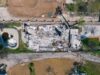
That distinction matters because “wetter” is not the same as “better.” Rain can restore a low stream, recharge a marsh or improve drought conditions. The same rain can also produce high water, mud, erosion, washouts and dangerous crossings. NOAA warns that heavy precipitation falling on dry soils can contribute to flash flooding and mudslides.
A public area can be biologically improved and practically inaccessible at the same time.
What anglers should actually watch
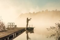
For an angler, the useful question is not whether El Niño means more water. It is what the water is doing now.
- Check current streamflow and lake levels.
- Look at water temperature, not just air temperature.
- Expect turbidity after major storms.
- Confirm boat-ramp and access-road conditions.
- Check fish-return forecasts and temporary closures.
- Know whether dam releases are changing the river.
- Decide in advance what conditions will make you turn around.
More flow can reconnect habitat and improve conditions after drought. It can also move fish, obscure structure and create currents that are beyond the ability of a boat or a tired angler to manage.
NOAA Fisheries says scientists cannot yet determine precisely how this El Niño will affect every local fishery. The agency is using vessel and aircraft surveys, uncrewed vehicles, forecasting models and cooperative research with commercial and recreational fishermen to track the changes.
That uncertainty is not a weakness in the forecast. It is the reason local information remains necessary.
More water will not produce the same result everywhere
NOAA Fisheries expects the West Coast and Pacific Islands to feel the most direct marine effects because El Niño begins in the Pacific Ocean. Warmer water can shift the distribution of fish. In Southern California, NOAA is already documenting species such as wahoo, striped marlin and yellowfin tuna appearing farther north than usual.
That may create opportunity for some recreational anglers. It may also bring harmful algal blooms, altered food supplies, changes in salmon and rockfish conditions, or additional stress for marine mammals.
In the Southeast, El Niño is generally associated with increased winter precipitation. Extra freshwater entering Gulf estuaries can lower salinity and affect shrimp, crabs and shellfish aquaculture. Rain may help one part of the system while making it harder for growers and fishermen to reach or harvest their operations safely.
Those examples are useful because they show how quickly a broad weather signal becomes a local management problem. Timing, location and intensity matter more than the label on the map.
Hunters will feel the forecast through access
For hunters, El Niño will usually matter indirectly.
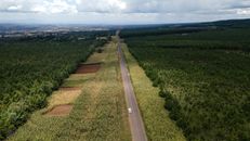
Roads may be muddy or snow-covered. A late-season storm may change animal movement, while a warm spell may remove the snow that made tracking possible. A wet winter can improve forage in one area and damage a culvert, bridge or trail in another. The weather may be favorable for wildlife and unfavorable for the person trying to recover an animal safely.
None of that is a direct NOAA prediction of deer, elk, quail or waterfowl numbers. It is the practical chain that connects weather to a hunt.
A hunter should therefore use the seasonal outlook to prepare equipment and alternatives, not to decide that a particular property will be productive. Check the forecast again before leaving. Check the road. Check the access rules. Carry clothing for conditions that are worse than the forecast. Have a recovery plan that does not depend on a single vehicle reaching the same place in the afternoon that it reached in the morning.
It is not glamorous preparation. It is the part that keeps a routine trip from becoming a rescue call.
Guides and land managers have a harder job
Guides and outfitters live in the gap between regional probability and customer expectation. A client may hear “strong El Niño” and arrive expecting a wet river, easy access or ideal winter conditions. The guide still has to deal with a closed road, a changed launch point, a damaged bridge or water that is too dangerous to fish.
That may mean alternate water, delayed departures, additional fuel, more equipment or a canceled trip. The forecast is valuable because it gives a guide time to prepare for those possibilities. It is not valuable if it encourages a guide to promise conditions that have not arrived.
Public-land managers face the same problem at a larger scale. Rain can improve habitat while damaging the roads, culverts, campgrounds and boat ramps people use to reach it. If infrastructure is already failing, more precipitation may expose the weakness rather than solve it.
This is where weather becomes a maintenance issue. A forecast can identify a risk. It cannot repair a road.
Use NOAA’s newer tools, then look closer
NOAA says the National Weather Service’s Probabilistic Precipitation Portal is operational for the 2026–27 winter season. The tool provides low-end, expected and high-end estimates for snow, ice and rain, along with probabilities of exceeding selected thresholds.
That is more useful than a single number because outdoor decisions often depend on the high end. A road that handles ordinary rain may not handle a heavy burst. A river that is fishable at expected flow may not be safe after an upper-end event.
But even a better tool is still a planning tool. Before leaving, check the local forecast, river gauge, water temperature, snow or precipitation reports, road notices, refuge closures and land-manager alerts. If those sources disagree, the ground usually wins the argument.
The forecast is useful when it changes your behavior
The public will hear that El Niño may bring a wetter winter to the South and East and warmer conditions across much of the North. That is a fair summary, provided it remains a summary.
The field version is more practical:
- Bring recovery equipment.
- Carry dry clothing and extra fuel.
- Identify another access point.
- Check gauges instead of relying on an old report.
- Confirm closures and temporary restrictions.
- Do not cross rising water because the trip was already paid for.
- Leave enough time to turn around.
Norman Hargrove’s recent analysis of the El Niño signal made the scientific point: a strong event changes probabilities, not the weather of every particular place. The outdoor consequence is straightforward. A forecast deserves attention, but it does not deserve obedience.
Use it to decide what to watch, what to carry and what alternatives to line up. Then check the river, the road, the snow and the wind before you commit.
The atmosphere deals in probabilities. The field deals in conditions. Good judgment is knowing the difference.